Commercial & Residential Land Surveyor Services Provided
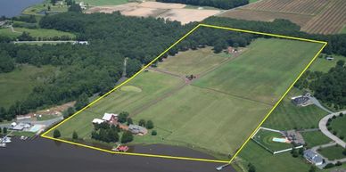
ATLA / NSPS Land Title Survey
ATLA / NSPS Land Title Survey
ATLA / NSPS Land Title Survey

An ALTA/NSPS Land Title Survey is a detailed survey performed in conformance with standards set forth by the American Land Title Association and the American Congress on Surveying and Mapping. They are often required for real estate transactions involving high value properties. The standard specifies accuracy and what is to be included in the survey. The “Optional Table A Requirements” is a list of optional items the client may want to include in the survey. The client provides a title report which identifies matters of record which affect title to the property. These matters are listed as “Schedule B Exceptions” within the “Commitment for Title Insurance” issued by a title company. We will review the commitment and provide an opinion on the face of the survey as to how the exceptions and other matters affect the property then we certify that the survey was performed in conformance with the standard.
Boundary Survey
ATLA / NSPS Land Title Survey
ATLA / NSPS Land Title Survey
Boundary Surveys are undertaken to determine the location of property lines and the actual physical extent of property ownership, typically witnessed by monuments or markers. We perform courthouse research to obtain deeds for the subject and adjoining properties which represent ownership, easements and other interests. We then perform fieldwork to locate property monuments such as iron pins, blazes in trees, piled stone corners or other types of monuments and also note encroachments and other occupations of the property which may affect ownership. A map or plat, which represents the completed survey, is then drawn from the data showing all property lines, dimensions and measurements.
Topographic Survey
ATLA / NSPS Land Title Survey
As-Built and Record Surveys

A Topographic Survey determines the positions of natural and man-made features and configuration of the terrain on a particular piece of land. The elevations of the measured points are represented as contours and spot elevations on a drawing. The finished drawing shows the location of all visible improvements such as roads, driveways, buildings, walls, fences and sidewalks. The survey also shows any above ground evidence of utilities such as manholes, valves and fire hydrants. The inverts of all sanitary sewer and storm drainage structures are also measured and shown on the survey. The scope of survey can be broadened to include a more intensive Utility Survey. Trees are generally not located unless a Tree Survey is specified by the client.
As-Built and Record Surveys
As-Built and Record Surveys
As-Built and Record Surveys

An As-built or Record Survey is the location and measurement of improvements as constructed. They are often required by lenders or authorities to confirm that new construction conforms substantially to the design or construction drawings and specifications.
Subdivision and Platting
As-Built and Record Surveys
Subdivision and Platting
Subdivisions and platting are when an existing parcel is subdivided into smaller lots or multiple tracts and also when multiple parcels are combined into a larger tract. The process varies with jurisdiction and involves a process of reviews, hearings and approvals by the local planning departments and recording at County Register of Deeds.
Construction Staking
As-Built and Record Surveys
Subdivision and Platting

Construction Staking is the process of interpreting an engineer’s or architect’s design drawings and locating or laying out the proposed improvements on the ground with stakes for contractors to use for subsequent construction. We lay out buildings, walls, curb, roads, utilities and any other proposed structure whose location or elevation is critical. ~Newcomb Land Surveyors, PLLC, Raleigh, NC
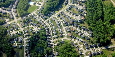
Residential Services
Buying or selling? Why survey?

Buying or Selling Property Survey:
- Define exactly what is being bought and/or sold
- Show the location of all improvements (such as buildings, fences, drives, etc.)
- Determine whether the legal deeds reflect the actual property. We can update the deed as necessary, which will preserve your property rights into the future
- Provide physical markings of the described property corners & along property lines, if desired
- Locate any easements that may impact the property
- Identify any encroachments by adjoining property owners
- Determine if property is impacted by floodplain
- Be necessary prior to potentially subdividing property
- Assure proper location of new construction
Boundary, Topographic & Tree Location Surveys may be required for Site Plans, as required by Local Governments for property improvements such as new construction or additions. Newcomb Land Surveyors is familiar with the local city and county requirements with regard to Site Plan requirements. ~Newcomb Land Surveyors, PLLC, Raleigh, NC
Residential Lot/Property Survey
A Lot Survey depicts or notes the position of boundaries with respect to:
- locations of all boundary monuments found or set
- apparent improvements and features, including as a minimum: dwellings, barns, garages, sheds, driveways, roadways, surface utilities, visible bodies of water and swimming pools
- record easements and visible evidence of the use thereof
- record and apparent means of ingress and egress
- lines of occupation, including as a minimum: fences, walls, hedges and yards
- deed restrictions pertaining to the location of buildings or other apparent improvements
- unresolved conflicts with record deed descriptions and maps
- all apparent boundary encroachments
We perform courthouse research to obtain deeds for the subject and adjoining properties which represent ownership, easements and other interests. We then perform fieldwork to locate property monuments such as iron pins, blazes in trees, piled stone corners or other types of monuments. We also note encroachments and other occupations of the property which may affect ownership. A map or plat, which represents the completed survey, is then drawn from the data showing all property lines, dimensions and measurements.
Plot Plan for a Permit
Plot Plan for a Permit
A plot plan is an architectural drawing that shows all the major features and structures on a piece of property. The information on a plot plan will generally include the following:
- Location of all buildings
- Porches
- Decks
- Sheds
- Swimming pools
- Landscaping features
- Boundaries of the property
Plot plans are typically required with all permit and zoning applications submitted to local permitting agencies. They may be used during zoning reviews or as part of the construction permit review process to help ensure there are no conflicts with building codes before a permit is issued. Plot plans are also used to help plan landscaping and hardscaping designs.

🔎REQUEST A QUOTE FOR ANY SURVEY SERVICES 💵🕒🧭❔
- Click “QUOTE REQUEST FORM” at the top of the homepage.
- Select EXISTING CLIENTS or NEW CLIENTS:
- EXISTING CLIENTS: Enter the email used to create your account. A link will be sent to login to your client hub.
- NEW CLIENTS: Fill out a quick form to get started.
- You’ll also have the option to upload any supporting documents at the end of the form.